Oregon Health Center Landscape
tableau
healthcare
geospatial
An interactive dashboard visualizing health center service delivery sites across Oregon.
Project Overview
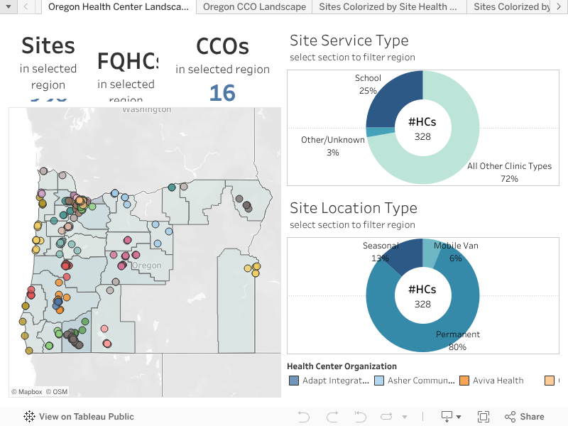
This visualization maps the service delivery landscape for the Oregon Primary Care Association (OPCA). The goal was to provide stakeholders with an interactive tool to identify health center locations, understand service coverage, and analyze the distribution of access points across the state.
The data is sourced from the HRSA Health Center Service Delivery dataset.
The Dashboard
TipInteraction
Feel free to zoom in on specific counties or click on individual clinic dots to see site-specific details.